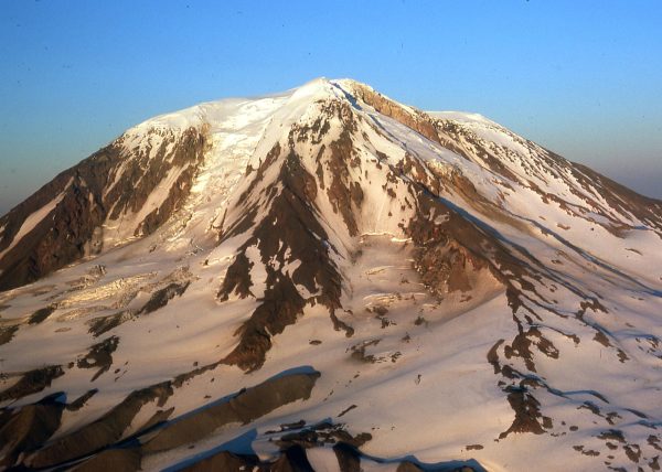
40 million years ago, the Cascade Mountain Range was formed, the result of the incredible forces of the earth’s tectonic plates colliding together and forcing the earth upwards to create those inspiring icy peaks. The impressive mountain chain stretches from foggy temperate Northern California to the intimidating wilderness of British Columbia, traveling through Oregon and Washington.
Recently, some Northwest residents have worried that one of those peaks may be at risk for eruption after a series of small earthquakes were recorded at Mount Adams and residents around Western Oregon and Washington reported a sulfur smell in the air. I spoke with several local experts to get some background insight on the region’s geologic history and see if people are right to be concerned.
Visiting Instructor of Geology, Gui Aksit, teaches Intro to Geology at Whitman and will be teaching a new class in the spring called Nature’s Fury, centered around the examination of natural hazards. Aksit described the geological processes that fashioned these volcanoes.
“We have a region off the [west] coast where…the Juan de Fuca Plate is going under the North American Plate. This is called the Cascadia Subduction Zone,” Aksit said.
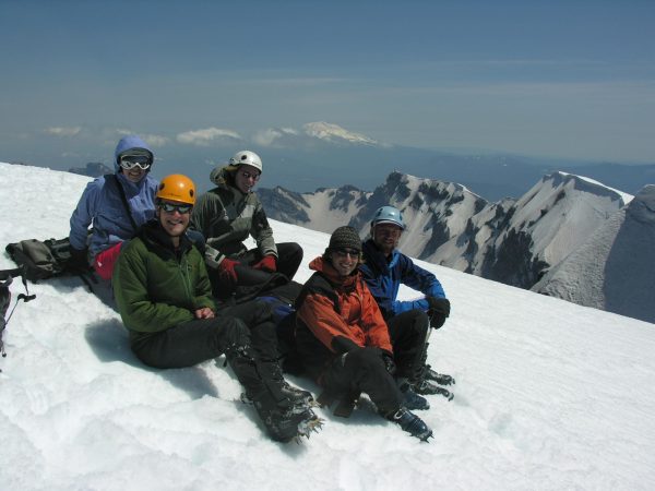
They further explained how mountains are created through subduction, beginning from a reservoir of magma under the earth’s surface that eventually becomes pressurized. This leads to magmatic dikes, which are sheets of magma that come up to the surface, often causing small eruptions. The magma emerging from the eruption doesn’t travel far before solidifying. Over millions of years, the pile up of magma leads to the build up of peaks that eventually form mountains.
“When there is subduction, at some point [the Juan de Fuca] plate is underneath [the North American Plate] and it will start to release water and cause melting in the plate above it. With all of this melting, you tend to get volcanic arcs, associated with subduction zones,” Aksit said.
The volcanic arcs Askit describes are the beloved Cascade Mountains.
She also mentioned the potential risks that this plate convergence can pose, including earthquakes and eruptions – something on many people’s minds in the Pacific Northwest. She gave the infamous 1980 eruption of Mount St. Helens as an example.
“What happened with Mount St. Helens is that we had this normal filling up of the magma chamber and eruption. Sometimes that magma, for whatever reason, has a lot of gasses in it. And when you have a lot of gasses, combined with viscous magma, you might get a more explosive eruption. So instead of having nice little flows, you get the big bang. When you have that style of eruption, suddenly it’s not these lava flows just traveling close to the volcano, you’re getting plumes of ash…that can travel really far with the wind,” Aksit said.
Whether you live near the Cascade Mountain Range or not, you may have seen some buzz on social media in the last few weeks about the prospect of a Mount Adams eruption.
After geologic reports emerged that Mount Adams experienced an unusual six earthquakes in the month of September (as opposed to its usual two to three a year), rumors swirled that an apparent sulfur smell, noticed by some people in Portland and Seattle, was also related.
Some social media users predicted 9.0 magnitude earthquakes and city-destroying tsunamis.
I met with Bob Carson, iconic Phillips Professor of Geology and Environmental Studies Emeritus who, after many minutes scouring over a geological map in the science building, disproved the rumors circulating.
“This business of Mount Adams having some very small magnitude earthquakes: I don’t know what to make about it. Adams is really big, but its glaciers are nowhere near the size of the ones on [Mount] Baker and Glacier Peak. The east half of Mount Adams is on the Yakama Reservation and the west half is pretty much wilderness. So I don’t think Adams is particularly hazardous,” Carson said.
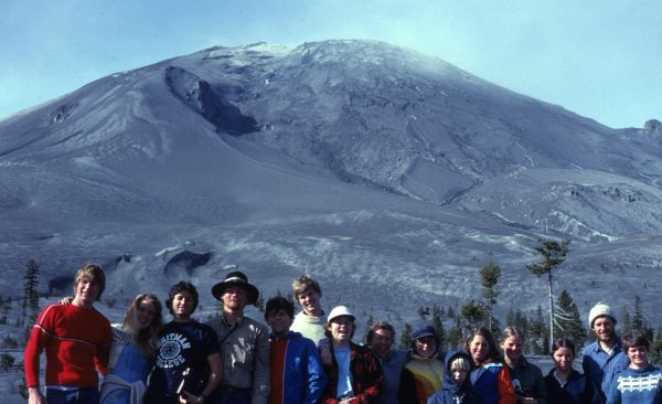
Carson contrasted the essentially nonexistent “warning signs” of Mount Adams with the alarmingly rapid change of Mount St. Helens, which he witnessed, taking Whitman students on and above (by plane) the mountain in the days leading up to the massive 1980 eruption. He explained that any true warning signs would be much more pronounced than what is being recorded at Mount Adams.
“Either [a] volcano is going to start swelling, or the composition of its gasses are going to change, or the sides are going to tilt or there are going to be earthquakes,” Carson said.
He went on to describe the eruption at Mount St. Helens.
“The first earthquake was on March 20, 1980, and it started erupting on March 27. I started taking students there on March 30 and every two weeks we went [to see it]… But the day of the big eruption was Sunday, May 18, in the middle of exam week, so I wasn’t there with students. The summit of Mount St. Helens was moving north at 1.5 meters a day. It was deforming very, very rapidly. Since the summit was moving north it meant the north side was getting steeper, and the students and I saw this,” Carson said.
Each Cascade mountain is ranked by a risk assessment system created by the USGS, the federal agency responsible for overseeing all things geologic.
This risk system monitors volcanoes through various technologies. It then ranks the risk of each volcano, spanning from “green-normal” to “yellow-advisory,” “orange-watch” and “red-warning.” The United States Geological Survey (USGS) agency says that these levels not only indicate risk, but also “concern.”
Therefore, a “high” ranking does not necessarily suggest a volcano is at imminent risk of erupting. Rather, it signifies the degree of danger and consequence in the event of an eruption.
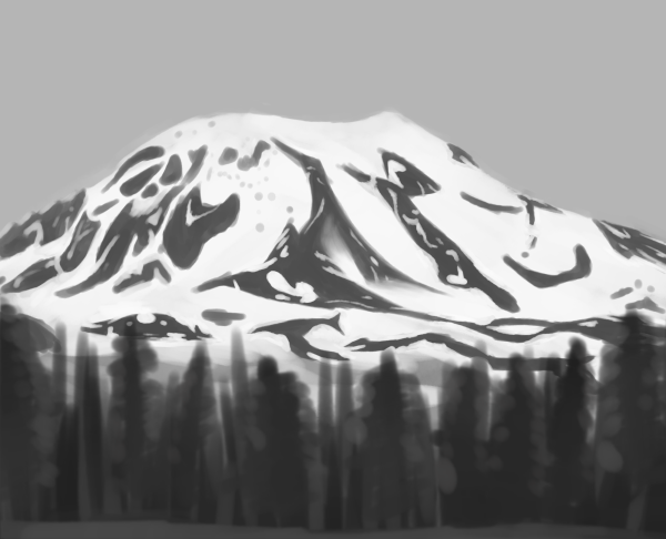
Mount Adams has been labeled as a “high-risk” Cascade mountain. It is near several small communities like Trout Lake and Glenwood, as well as the Yakama tribal nation on the Eastern side of the Mountain. The biggest threat to these places is the volcanic mudflows that might occur during or after a volcanic eruption. However, as Carson said, Mount Adams is at a very low risk for actually erupting. The communities nearby are very small and could most likely be alerted and evacuated early on and quickly, and despite its recent increase in earthquakes, it is showing no significant warning signs.
All active volcanic mountains in the Cascadia zone receive 24/7 monitoring. This is done through technology that mostly post-dates the Mount St. Helens eruption, giving the field of geology a new technological edge.
A seismometer is a tool that can pinpoint the depth and location of an earthquake in a volcano. The USGS currently has twenty permanent seismometers at Mount St. Helens, six at Mount Rainier, and four at Mount Adams, three of which were recently installed by the Forest Service in the past few weeks.
So while the previous singular seismometer at Mount Adams picked up an increase in the frequency of earthquakes at the mountain, since the addition of a few new temporary stations, the majority of these earthquakes have been determined to be very shallow and small in their magnitude. This indicates magma is not pushing up toward the “vent” (opening) of the mountain.
The USGS also has Global Positioning System (GPS) stations placed around the base of the mountain to pick up small changes to the shape of the mountains. A tell-tale sign of a potentially erupting volcano is a change in the typical swollenness of the “cone” or “body” of the volcano. A GPS station’s data will show if a volcano is expanding outwards or forming any unusual shapes, which can signal that magma is being pushed upwards. Mount Adams’ GPS stations have shown no such changes.
Lastly, the USGS has stations that monitor the levels of gasses such as sulfur dioxide, carbon dioxide, and hydrogen sulfide that are being emitted by a volcano.
So, as for the supposed sulfur smell, while a volcanic mountain would surely seem like the most suspicious culprit, it cannot be confirmed that this is the case for any of the active Cascade Mountains, as none of their gas stations have picked up an increase in sulfur dioxide. Additionally, if the mountain was releasing large amounts of gas, it would experience the other accompanying symptoms, like the bloating of the cone and large earthquakes.
I spoke with Jon Major, Scientist-in-Charge at the Cascades Volcano Observatory in Vancouver, Washington. His observatory is responsible for assessing hazards and monitoring volcanoes in Oregon, Washington, and Idaho. When I asked about Mount Adams’ recent seismic activity, he reiterated that we currently have no reason to be alarmed about an eruption in the near future.
“For whatever reason, Mount Adams has been a bit noisier this year, and particularly since September… [However,] there is no particular concern about them right now [as] there are no other signs indicating that magma has moved or is moving up into the volcano… There is no indication that unusual amounts of gas are being emitted, which we would expect if magma was nearing the surface. But, we remain vigilant and will intensify our monitoring efforts if there is any indication that the volcano is entering a state of unrest,” Major said.
Ultimately, residents of the Pacific Northwest can rest assured that all is well in the world of Western volcanoes (at least for now) and we have geology to thank for that assurance. How lucky we are to have people who are so passionate about the natural hazards that could impact many.


